


01
Where to test the soil?
Nirby analyses field variability in satellite images and places zones and measurement points.

Real-time soil analysis, right in the field
We are building the world's first autonomous drone that tests soil on the spot, without sending anything to a lab. A research and development project co-funded by the European Union.
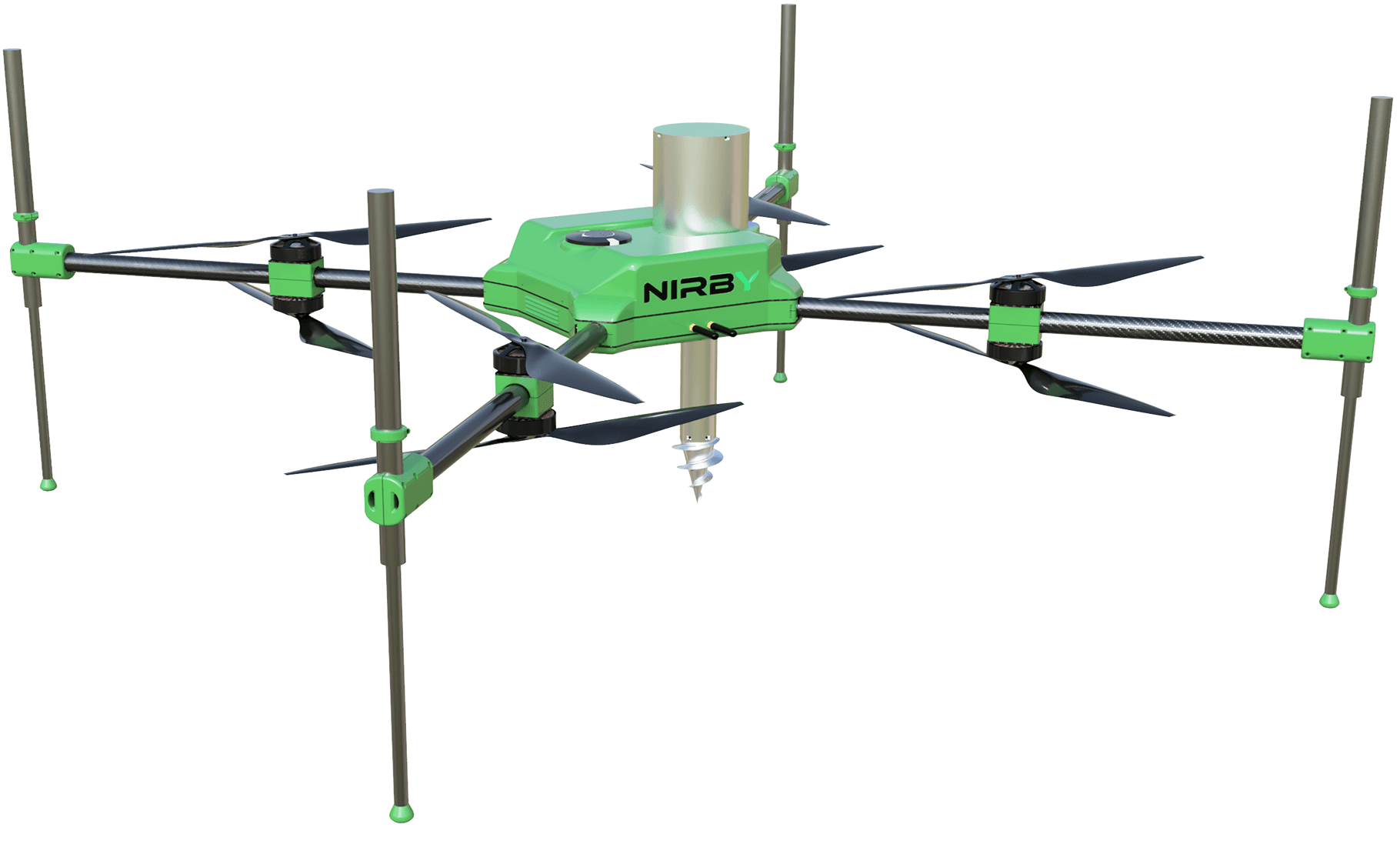
Soil analysis without a lab
The drone is designed to analyse soil directly in the field, without taking samples and sending them to a lab.
Measurement points from satellite data
Nirby places the measurement points based on the field variability visible in satellite images.
Results straight into the fertiliser plan
Results are meant to go straight into nutrient maps, fertiliser plans and VRA maps in Nirby.
Traditional soil testing takes weeks. Fertiliser decisions can't wait.
Today samples are taken by hand, packed and sent to a lab. By the time the results come back, the fertilisation window has often passed. Nirby's drone is meant to shorten this to a single visit to the field.
Three steps from a satellite image to a VRA map.
The drone is part of Nirby's precision agriculture workflow. The satellite shows where to test, the drone tests the soil, and the system turns the results into fertiliser rates for every zone of the field.
Nirby analyses field variability in satellite images and places zones and measurement points.
The drone flies to each point and analyses the soil on the spot, without taking samples.
Results go into Nirby, which builds nutrient maps, the fertiliser plan and a VRA application map for the machine.
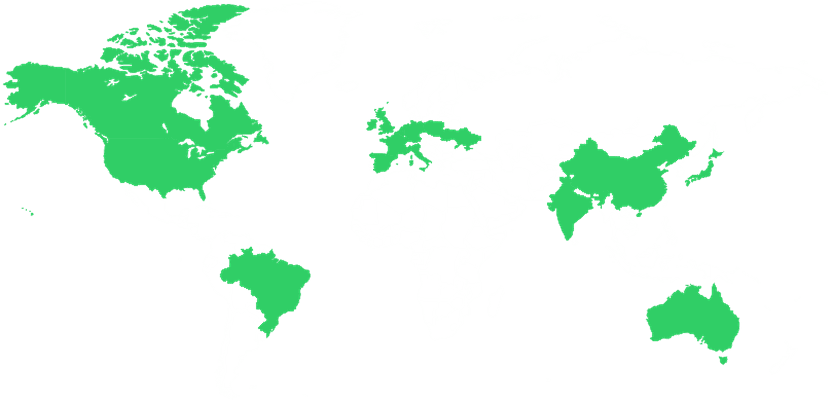
Technology protected by patent applications in 16+ countries.
We are developing the drone in a research and development project co-funded by the European Union under the European Funds for a Modern Economy programme.
Everything works together across the whole farm.
Nirby is one farm management system. Data entered in one place is available straight away in every other module.
Get one year of platform access worth PLN 240 at no cost
Before the drone reaches the fields, the whole soil testing workflow already runs in the Nirby platform: satellite sampling zones, navigation to the points in the mobile app, lab results, nutrient maps and fertiliser plans.
Start for freeha with:
Core, Farm Management, and Precision Agriculture
Choose modules| Standard annual price24 PLN / ha / year × 10 ha | |
|---|---|
| Offer: first year free, up to PLN 240 | − |
| Your first-year total |
Frequently asked questions about drone soil testing
No. The drone is a research and development project and is not on sale yet. You can already run soil testing in Nirby today, though: it places sampling zones, guides you to the points in the mobile app and turns lab results into nutrient maps and fertiliser plans.
Nirby places measurement points based on satellite data. The drone flies autonomously to each point and analyses the soil on the spot, without taking samples. The results go into Nirby, where they are used to build nutrient maps, fertiliser plans and variable-rate (VRA) maps.
In traditional testing, samples are taken by hand and sent to a lab, and results usually take from a few days to a few weeks. The drone is designed to analyse soil directly in the field, without samples or a lab, so the result is available straight away, before the fertiliser decision.
The technology is covered by patent applications in more than a dozen countries, including the USA, Canada, Japan, China, Australia, Brazil, India and Europe. These are patent applications, not granted patents.
The project is carried out by Nirby Sp. z o.o. and co-funded by the European Union under the European Funds for a Modern Economy programme, agreement no. FENG.01.01-IP.02-3237/23.
Do you work with farmers? Let’s build something together.
Nirby can connect farmers, advisers, laboratories, distributors and crop buyers around the same data. Tell us how you work and we’ll suggest a practical partnership model.
Add fertiliser plans, application maps and crop monitoring to your offer. Advisers can work from the same field data as the farmer and discuss specific management zones instead of relying on whole-field averages.
We define sampling zones from satellite imagery and turn lab results into nutrient maps and precision fertiliser plans. You collect the samples; the farmer receives clear recommendations and machine-ready files.
Bring supplier field-operation and crop-protection records into one digital standard. That makes crop traceability, reporting and contract-growing programmes easier to manage.


