


Start with your fields
Add your fields in minutes and get a digital farm map, satellite crop monitoring and weather forecasts — free.

From satellite imagery to your farm’s bottom line
Poland’s most awarded digital farming platform.
 Kombinat Rolny Kietrz
 DANKO Hodowla Roślin
Start with your fields
Add your fields in minutes and get a digital farm map, satellite crop monitoring and weather forecasts — free.
Then add your documents
Upload a PDF or Excel invoice. Nirby reads the line items and prepares the inventory receipt for you to review and approve.
Then Nirby keeps everything in sync
Record a field operation once and Nirby updates the field history, inventory, crop protection records, fertiliser plans and financial analysis.
Tired of juggling multiple tools? Run it all in Nirby.
Nirby brings your fields, satellite data, soil, fertilisation, field operations, inventory, machinery, teams and finances into one system. Enter data once and use it everywhere — no retyping, no hunting through spreadsheets, no paper notes.
Satellite monitoring, soil data, fertiliser plans, variable-rate maps, crop protection records, inventory and work management — all in one browser-based platform.
„I’ve watched technology transform Polish agriculture for years. Nirby is one of the most promising solutions developed in Poland — combining world-class science with the practical needs of farmers. I recommend it to anyone serious about the future of their farm.”
 Vice-President of ARiMR, prof. MANS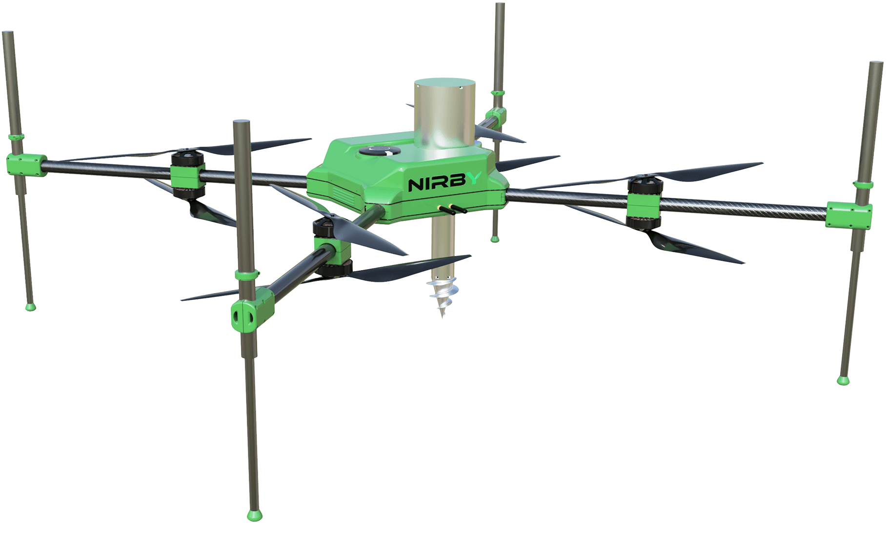
Precision agriculture, without the complexity.
Nirby analyses field variability, helps define soil-sampling zones, connects lab results with fertiliser planning and takes you all the way to a machine-ready variable-rate map. One clear workflow, step by step.
Assign crops to fields and plan the season’s cropping structure. Nirby keeps track of crop history and previous crops, then carries that context into fertiliser planning, field operations and record-keeping.
Sentinel-2 monitoring lets you compare every field without constantly driving around the farm. NDVI highlights biomass differences, NDMI helps track water conditions, and NDRE adds insight in later growth stages. Outliers stand out on the map, so you know where to inspect first.
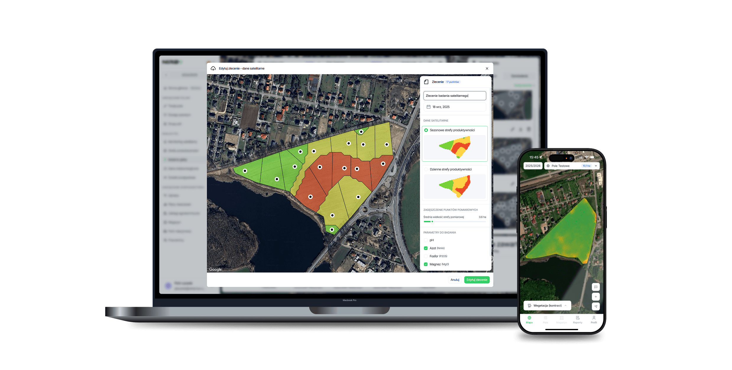
Nirby uses satellite data to define soil-sampling zones and optimise the sampling route. The mobile app guides the operator from point to point. Once lab results are added, Nirby maps them back to the correct zones and builds nutrient maps that feed directly into fertiliser plans and application maps.
Nirby creates fertiliser recommendations for each field zone using soil nutrient levels, crop requirements, Nitrates Directive rules and eco-scheme requirements. The resulting fertiliser plan can then be converted directly into a VRA map.
Nirby exports the variable-rate map as ISOXML or Shapefile for a compatible ISOBUS terminal. The machine applies the prescribed rate in each zone, and the completed operation is written back to the field history — keeping the workflow from soil analysis to execution fully connected and documented.
Enter data once. Nirby takes it from there.
Nirby processes invoices and prepares inventory receipts automatically. Use that data to plan a field operation, send a job card to the operator, and once the work is completed, update the field history, inventory and crop protection records automatically. The same data moves through the entire workflow without being entered twice.
Explore digital crop protection recordsUpload your documents and Nirby prepares the inventory entries for review.
Choose the fields, date and products. A single plan can cover multiple fields.
The operator receives it in the mobile app. Once the work is done, they simply move the card to completed.
Once the work is recorded as completed, Nirby updates the crop protection register and field history.
| Date | Field | Product | Permit no. | Dose | BBCH | Status |
|---|---|---|---|---|---|---|
From work in the field to the farm’s bottom line.
Nirby connects work reports, inventory, machinery and finance. Every completed operation updates the next part of the system, giving you a live view of what is happening across the farm.
Explore production cost analysisOperator, field, machine, operation and working time — all captured in one report.
When an operation is completed, Nirby records the products used and assigns their cost to the relevant field.
Working time and the machine rate are used to calculate the true cost of each operation.
Costs and revenue roll up into profit or loss for each field and for the farm as a whole.
Polish technology recognised in Poland and internationally.
Nirby has received 18 awards and distinctions for technology built for modern agriculture, with recognition from organisations including Forbes Poland, the University of Pennsylvania and Huawei.
 Ranked #1 among Poland’s top bootstrapped companiesForbes Poland recognised Nirby in its 2025 ranking of leading Polish technology companies.Read more
 Startup Challenge 2024 at the University of PennsylvaniaNirby won four of the five main prizes, with a combined value of $80,000.Read more
 1st place in a 2026 agricultural technology competitionA PLN 150,000 award for applying satellites, AI and drones to agriculture.Read more
 President’s Sustainability Prize 2025Nirby received a $150,000 award to develop technology for farm management and precision fertilisation.Read more













Start with the essentials. Add only what you need.
Nirby’s core platform is free. Add paid modules to match the way your farm operates, and pay only for the functionality you actually use.
Get one year of platform access worth PLN 240 at no cost
Add your fields and start running the farm with less admin. Many core features remain free even after the promotional period ends.
Start for freeha with:
Core, Farm Management, and Precision Agriculture
Choose modules| Standard annual price24 PLN / ha / year × 10 ha | |
|---|---|
| Offer: first year free, up to PLN 240 | − |
| Your first-year total |
Frequently asked questions about Nirby
Nirby is farm management software that brings day-to-day farm operations and precision agriculture into one platform. Manage fields and crop rotation, monitor crops from satellite data, plan soil testing and fertilisation, create VRA maps, keep crop protection records, manage inventory, machinery and teams, and track production costs per hectare — all in one place.
Yes. Nirby combines everyday farm management with precision-agriculture tools. You can plan crops and field operations, manage inventory, staff and machinery, while using satellite monitoring, soil testing, fertiliser planning and VRA maps in the same system.
Nirby is particularly well suited to medium and large farms managing many fields, operators, machines and field operations, including large-scale commercial farms. Smaller farms can start with the free core platform and add modules as their needs grow.
Yes. Nirby builds digital crop protection records from completed field work. The field, date, product, application rate and completion data stay linked to the field history, job card and inventory, so compliance records update as part of the normal workflow.
Nirby tracks fertilisers and crop protection products and connects inventory with purchases and completed field operations. Approved purchase documents add products to stock, while completed work can automatically deduct usage and assign the cost to the correct field.
Nirby uses AI to read PDF and Excel invoices, identify products, quantities and prices, and prepare the inventory receipt. You review and approve the data before anything is posted. The same invoice data can then support field planning, product usage tracking and cost analysis.
Satellite field monitoring gives you a regular view of crop condition and variability within each field. Nirby uses Copernicus Sentinel-2 data to calculate indices such as NDVI, NDMI and NDRE, helping you spot areas that need a closer look in the field.
Nirby uses Sentinel-2 imagery from the Copernicus programme. The data supports crop monitoring, comparison of field variability and the creation of zones for deeper analysis.
Yes. Nirby uses satellite data to define soil-sampling zones, plan sampling routes and guide operators in the mobile app. Lab results are then assigned to the correct zones and converted into soil nutrient maps, fertiliser plans and VRA maps.
Yes. Nirby builds fertiliser plans from crop requirements, soil nutrient levels and lab results. Recommendations are calculated by field zone and can account for the Nitrates Directive and eco-scheme requirements. The plan can then be turned into a variable-rate map.
Nirby creates VRA maps from soil test results, nutrient zones and the fertiliser plan. Different parts of the field can receive different rates, so application follows the actual variability within the field rather than one average rate.
Export the finished application map from Nirby as ISOXML or Shapefile and load it onto a compatible ISOBUS terminal. The machine follows the prescribed rates by zone, while the completed operation remains linked to the field history and fertiliser plan.
Yes. Nirby lets you assign work to operators, send tasks to the mobile app and record completion. A work report can capture the operator, field, machine, operation and working time, which can then feed directly into cost calculations.
Yes. Nirby combines completed field operations, fertiliser and crop protection usage, labour time, machinery costs and other expenses. That gives you production cost per hectare, a clear cost breakdown, and profit or loss for each field and the farm as a whole.
Nirby’s core platform is free. Paid modules are priced per hectare of farmland per year, with no separate per-user fee and no implementation fee. Add only the modules that fit the size and needs of your farm.
Yes. Nirby is a Polish technology company building farm management and precision-agriculture software in Poland. The product is developed by a Polish team in close collaboration with commercial farms and through dedicated R&D projects.
Because the same field data can keep working after the agronomic decision is made. In Nirby, satellite monitoring, soil testing, fertiliser plans and VRA maps connect directly with field operations, inventory, crop protection records, teams, machinery and financial analysis.
Built in Poland. Shaped with our customers.
We build Nirby alongside farmers and large agricultural operations. Their day-to-day workflows, problems and priorities directly shape what we develop next.










Join a team where your work has a visible impact.
Do you work with farmers? Let’s build something together.
Nirby can connect farmers, advisers, laboratories, distributors and crop buyers around the same data. Tell us how you work and we’ll suggest a practical partnership model.
Add fertiliser plans, application maps and crop monitoring to your offer. Advisers can work from the same field data as the farmer and discuss specific management zones instead of relying on whole-field averages.
We define sampling zones from satellite imagery and turn lab results into nutrient maps and precision fertiliser plans. You collect the samples; the farmer receives clear recommendations and machine-ready files.
Bring supplier field-operation and crop-protection records into one digital standard. That makes crop traceability, reporting and contract-growing programmes easier to manage.


